![]() rowmaps
rowmaps
these web pages
are being produced by
Barry Cornelius
 Bluesky
home
maps
preferences
original data
missing data
KMLs
GPXs
CSVs
GeoJSONs
using Organic Maps
app on a phone
and getting it to
display rights of way
tweets
blog
contact
privacy
2025-09-17-0917
Dataset containing the public rights of way of Reading
The council of Reading have provided me with a gpkg file that has the details of their public rights of way. The gpkg file seems to have been created on 30th January 2025.
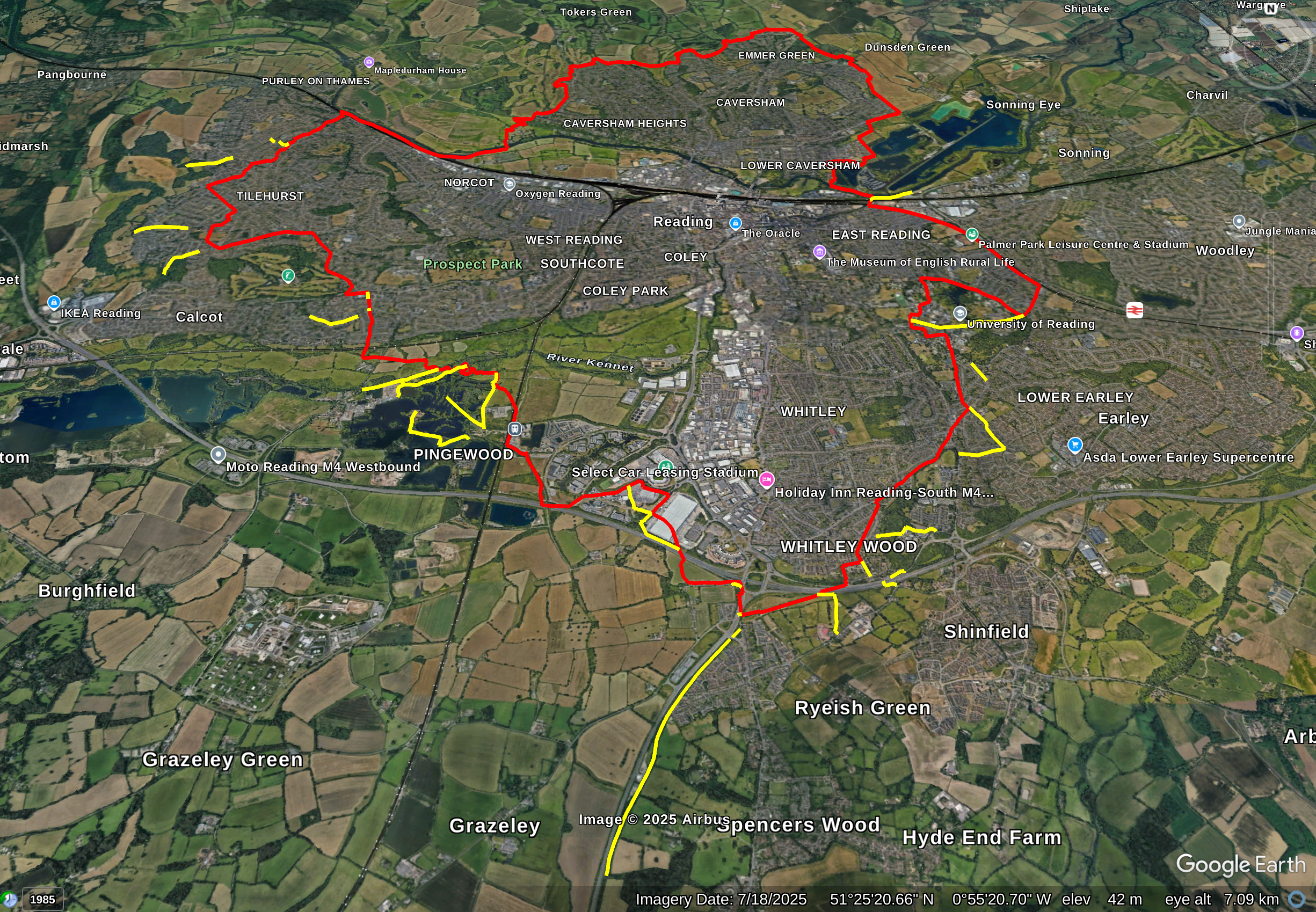
In October 2025, BC reported to me that the council's data has public rights of way that are outside Reading. On investigating, I found that there were 39 public rights of way that are outside Reading. In the council's data, these public rights of way have a PAR_NAME that is not READING. Here is a list of PAR_NAMEs that are used together with the number of paths that have that PAR_NAME: BURGHFIELD 10, EARLEY 5, SHINFIELD 13, THEALE 4 and TILEHURST 7. This screenshot shows GoogleEarth with the boundary of Reading (in red) and the paths (in yellow) that have a PAR_NAME that is not READING. My thanks to the Ordnance Survey as the boundary for Reading has been produced using their Boundary-Line product.
The Council also provides information about public rights of way in some maps that are on this web page. It may be that their maps use more up-to-date information.
An authority's Definitive Map is the authoritative source of their rights of way. The details of the public rights of way network contained in an authority's data are for information only, and are an interpretation of the Definitive Map, not the Definitive Map itself, and should not be relied on for determining the position or alignment of any public right of way. For legal purposes, an authority's data does not replace their Definitive Map. And changes may have been made to the Definitive Map that are not included in their data. The authority's data contains Ordnance Survey data © Crown copyright and database right 2026. Attempting to view this data with more detail than 1:10000 may produce an inaccurate rendering of the route of a public right of way.
The council of Reading have informed me that the gpkg file is made available under the terms of Open Government Licence v3.0. So it's possible for you to use this data provided you give the attribution that the data has been provided by the council of Reading.
Please e-mail me if you see a web page where the authority of Reading allows you to download the MapInfo files.
This web site also provides data about the rights of way of Reading in KML format, in GPX format, in CSV format and in GeoJSON format.